

Trail Updates Around Damascus
Get the latest trail updates for alerts and trail conditions around Damascus, Virginia. Know before you go. More information below on current conditions, including:
- Virginia Creeper Trail: OPEN from Abingdon to Damascus
- Virginia Creeper Trail: CLOSED upper half, set to reopen March 31, 2027
- Appalachian Trail closure, detour, and shuttle options for 2026 season
- New Burn Ban in Mount Rogers High Country
- Beartree Lake Restoration Project in 2025-26
- Feb-Apr: Virginia’s 4 PM Burning Law
This is Trail Town USA. Several major trails pass through the heart of Damascus, including the Appalachian Trail and Virginia Creeper Trail. Nearby are multi-use trails and motorized routes in Mount Rogers National Recreation Area, George Washington-Jefferson National Forest in Virginia, Cherokee National Forest in Tennessee, and Grayson Highlands State Park.
Damascus is your basecamp for adventure
Although the upper half of the Virginia Creeper Trail remains closed in the 2026 season, Damascus has many miles of other open trails nearby! Make Damascus, Virginia your basecamp for adventure. Check out some of our favorites in the region, from Grayson Highlands State Park in Mouth of Wilson, to one of our other neighboring rail-trails, the Mendota Trail in Bristol.
Looking to put in some big miles? Set your sights on the Appalachian Trail, Grayson Gravel Traverse, Overmountain Victory National Historic Trail, or TransVirginia Bike Route.

National Forest Maps
No signal? No problem! The new National Forests and Grasslands app by the Forest Service features offline maps, safety alerts, and a comprehensive set of recreation sites and trails – all for free. Download maps before you go:
Virginia Creeper Trail: Open

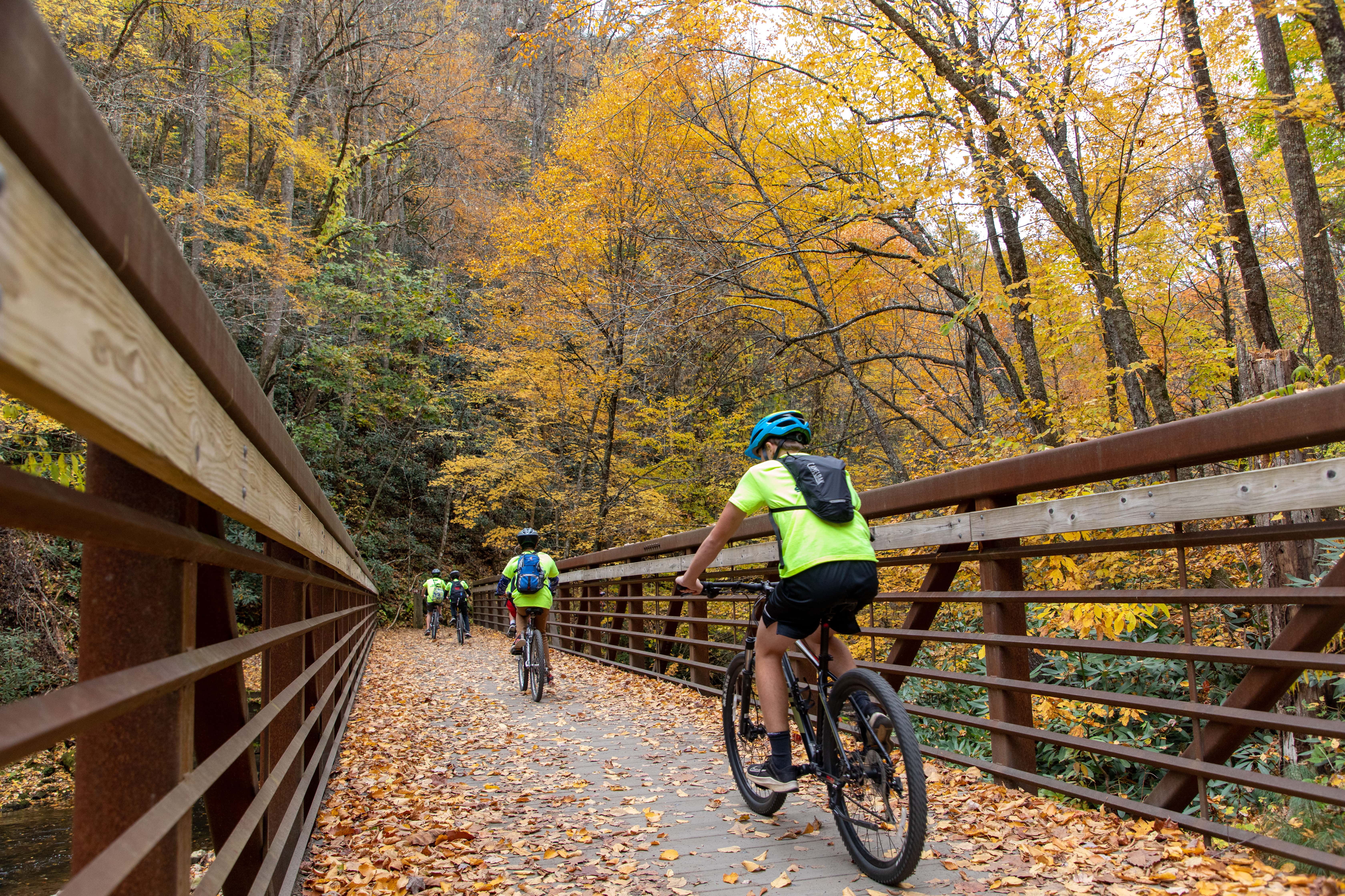
Half of the Virginia Creeper Trail is OPEN, from the Start to the Heart, Abingdon to Damascus, about 17 miles. Our bike outfitters are providing rental and shuttle services for the Abingdon to Damascus section. Now open to e-bikes as well!
Virginia Creeper Trail: Upper Half Closed


The upper half of the Virginia Creeper Trail, from Whitetop Station to Damascus, saw significant damage from Hurricane Helene in September 2024. The trail remains closed until it is rebuilt and is set to reopen on March 31st, 2027. There is no access to the Virginia Creeper Trail past Damascus at this time.
Work Zone: Please be alert to signage and barricades on the trail, and respect trail closures, for the safety of both the public and work crews. Closed area strictly enforced.
View all Closed Trails & Developed Recreation Sites near the Virginia Creeper Trail
Closed Trails & Developed Recreation Sites
- Virginia Creeper National Recreation Trail, Forest Service Trail (FST) 4575, from Trestle 16 in Damascus to the North Carolina-Virginia state line just past Whitetop Station
- Appalachian Trail from Highway 58 at Straight Branch Trailhead to Grassy Ridge Road/VA 859 (Northbound miles 476.6.0 to 485.8)
- Whitetop Laurel Fishing Trail (FST 4645)
- Taylors Valley Spur (FST 4651)
- Creek Junction Trailhead
- Straight Branch Trailhead
- Whitetop Station Parking Lot and Trailhead
- Green Cove Parking Lot and Facility
The Whitetop Station Visitor Center and Green Cove Station Visitor Center remain closed as well.


Virginia Creeper Trail Set to Reopen March 31, 2027
The Forest Service has announced that the Virginia Creeper Trail is expected to fully reopen on March 31, 2027. The Virginia Creeper Trail is a backbone of the local outdoor economy. The trail brings thousands of riders, families and visitors to Damascus, Abingdon and communities throughout Southwest Virginia each year. Now residents, outfitters, and nearby businesses have a clear timeline so they can plan ahead for next year’s tourism season.
Virginia Creeper Trail Groundbreaking
Virginia Creeper Trail Groundbreaking
The Town of Damascus, Virginia was delighted to celebrate the groundbreaking of the upper half of the Virginia Creeper Trail, on December 18, 2025, alongside the US Forest Service, Kiewit Infrastructure South Co., the Commonwealth of Virginia, and many regional partners and community members. This day marked a significant milestone in our recovery from Hurricane Helene in September 2024. As Mayor Lamb says, “We’re coming back better than we’ve ever been!” A year from now, we look forward to celebrating the ribbon-cutting with you. In the meantime, half of the Virginia Creeper Trail remains open, from the Start to the Heart, Abingdon to Damascus.
Virginia Creeper Trail Rebuild Contract
Virginia Creeper Trail Rebuild Contract
The Forest Service announced the award of the design-build contract for the Virginia Creeper Trail to Kiewit Corporation of Peachtree City, Georgia. This contract is valued at $240,580,432.12. This is for the full rebuild of the devastated upper 17-mile section of the trail between Damascus and Whitetop Station. This section of the trail remains under strict closure for the duration of the construction period, until otherwise noted. Estimated completion in Fall 2026. (posted Nov. 6)
Further updates will be shared here as they become available. Kiewit plans to share regular updates on its project website as well, linked below:


Appalachian Trail Detour
There is an Appalachian Trail closure and detour just north of Damascus in 2026. This closed area is strictly enforced. The trail is closed for 9.2 miles due to construction on the Virginia Creeper Trail. The closure area goes from US-58 at Straight Branch Trailhead to Grassy Ridge Road/VA 859. (Northbound miles 476.6.0 to 485.8). US-58 roadwalk NOT recommended. The Forest Service and Appalachian Trail Conservancy have two recommended detours for hikers.
A.T. Detour & Shuttle Options
Long distance hikers can bypass the closed area via other trails nearby.
- Northbound detour: Follow the Iron Mountain Trail from Damascus to the Flat Top Trail and Mount Rogers Trail. Reconnect with the Appalachian Trail at Deep Gap, 2 miles south of the Thomas Knob Shelter.
- Southbound detour: Follow the Mount Rogers Trail. Two miles south of Thomas Knob Shelter, hike from Deep Gap to the Flat Top Trail and Iron Mountain Trail. Reconnect with the Appalachian Trail in Damascus.

Hikers can also arrange a shuttle around the closed section. Recommended shuttle is from Damascus to Grassy Ridge Road/VA 859 or to US-58 at Summit Cut.
With these recommended detour or shuttle options, hikers can still experience the beautiful Mount Rogers High Country. Additionally, the Iron Mountain Trail was originally part of the Appalachian National Scenic Trail until 1972. Historic shelters remain available for overnight use.
Important Notes for multi-use
- Wear blaze orange. The Iron Mountain Trail is open to hunting. This includes the use of hunting dogs.
- Sections of the Iron Mountain Trail are multi-use. Stay alert and share the trail. Mountain biking, equestrian, and motorized use are allowed in some areas.
Note: This trail closure is partway between Damascus and the Whitetop Mountain/Elk Garden area. Hikers traveling between town and the Mount Rogers High Country must plan an alternate route for the 2026 season.
Burn Ban in Mount Rogers High Country
The Forest Service has issued fire restrictions for the Appalachian Trail through the Mount Rogers High Country. This burn ban is from Beech Mountain Road to Massie Gap (NOBO mile 489.4 to 502.4). Creating and maintaining campfires is prohibited. Use extreme caution with camp stoves and smoking. Pack out all trash.
This area is home to rare and critically imperiled southern spruce-fir forest. A host of rare, threatened, and endangered species depend on this forest. Hurricane Helene left behind storm debris and downed trees, creating the perfect fuel for wildfires to spread quickly. Follow these fire restrictions to help protect this unique ecosystem.

This burn ban (shown in red) is for all areas within a quarter mile of the Appalachian Trail.
beartree Lake Restoration Project
Beartree Lake has been drained and organic material is being removed from the lakebed. No fishing, swimming, or paddling. The bathrooms by the beach are closed. Potable water will not be available for the 2026 season. The picnic area and group picnic pavilion are closed. Portable toilets are available at the beach area parking lot, the group picnic pavilion, and the fishermen’s parking lot. This project will continue into the 2026 season.
The Chipmunk Loop at Beartree Campground will be open for camping starting on Thursday, May 13, 2026. Bathrooms and showers remain closed. All sites are first-come, first-served. $24 per site, per night.
Grindstone Campground
Grindstone Campground and its parking area is closed for the remainder of the 2026 season. The Forest Service will replace aging infrastructure and repair damage caused by Hurricane Helene. For Safety reasons please limit entry into the construction area.
Alternative parking:
Across from Fox Creek Horse Campground 36.696628, -81.5326411
At the Mount Rogers Trailhead 36.689230, -81.532605
Virginia’s 4 PM Burning Law
Virginia’s 4 PM Burning Law is in effect from February 15 through April 30 each year. It is important to note that some localities may have even more restrictive regulations on outdoor burning than the state’s 4 PM Burning Law. All burners are encouraged to check with their locality before starting any outdoor burning.
The 4 PM Burning Law bans open-air burning prior to 4:00 p.m. if the fire is within 300 feet of the woods or dry grass which could carry fire to the woods. Burning is allowed between 4:00 p.m. and midnight as long as the burner takes proper precautions and attends the fire at all times.
(Updated September 22, 2026)





You must be logged in to post a comment.