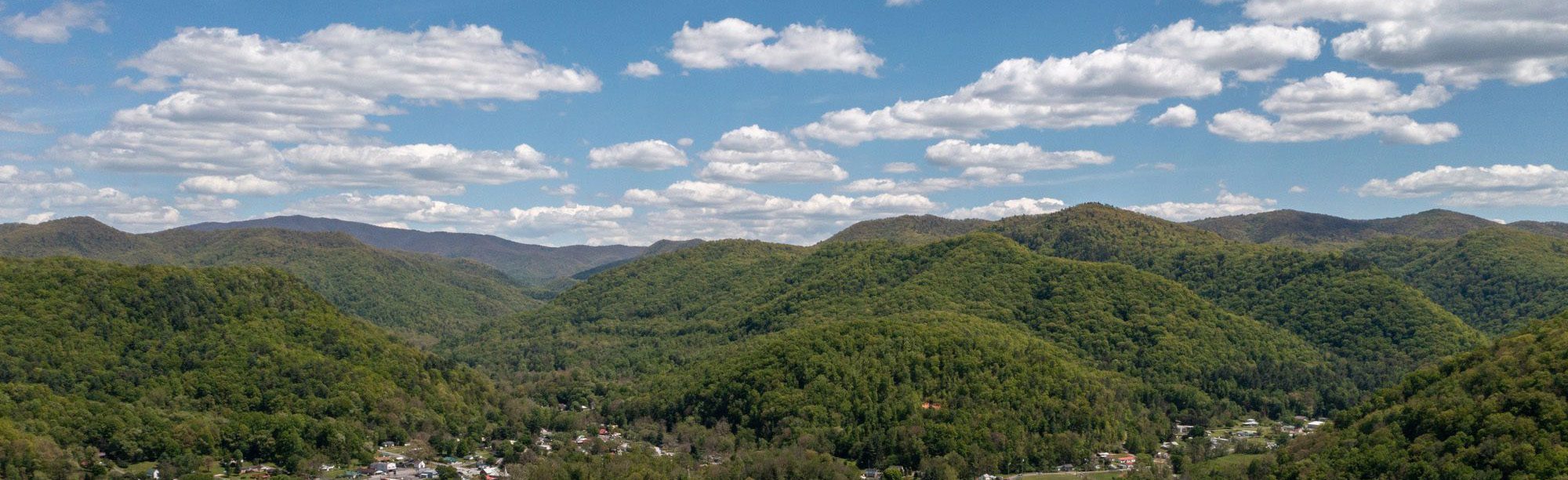



The Friendliest Town on the Appalachian Trail
The Appalachian Trail (AT) follows the sidewalk right through the middle of downtown and brings through an eclectic mix of hikers year-round. Whether out for just the day or set out on a months-long thru-hike, Damascus is truly a hiking destination. In the springtime, from April to June, is the “NOBO hiker bubble,” when we see most of the thru-hikers. Damascus is one of just three downtowns that are directly on the trail along its 2,200 mile length.
From here, its not far to one of the most scenic sections of the entire Appalachian Trail, the Mount Rogers High Country. Damascus, Virginia is a designated AT Community and the proud home of the Damascus Trail Center and Appalachian Trail Days Festival.
Trail Alert: 2026 A.T. Detour
The Appalachian Trail has a temporary detour near Damascus for the 2026 season. The trail is closed for 9.2 miles, from US-58 at Straight Branch Trailhead to Grassy Ridge Road/VA 859 (Northbound miles 476.6.0 to 485.8), to accommodate construction activities on the Virginia Creeper Trail.
More information on the 2026 Appalachian Trail closure
Long distance hikers can bypass the closed area via detours on other trails nearby. Alternatively, hikers can also choose to shuttle around the closed section. Recommended shuttle is from Damascus to Grassy Ridge Road/VA 859 or to US-58 at Summit Cut. US-58 roadwalk NOT recommended.
With these recommended detour or shuttle options, hikers will still get to experience the beautiful Mount Rogers High Country just north of Damascus, VA. Additionally, the Iron Mountain Trail was originally part of the Appalachian National Scenic Trail until 1972 and historic shelters remain available for overnight use.
Note: This trail closure is partway between Damascus and the Whitetop Mountain/Elk Garden area. Hikers traveling between town and the Mount Rogers High Country must plan an alternate route for the 2026 season.


More about the Appalachian Trail
The Appalachian National Scenic Trail (AT) is the world’s longest hiking-only footpath. The 2,200 mile long trail follows the crest of the Appalachian Mountains from Springer Mountain in Georgia to Mount Katahdin in Maine. The trail passes through fourteen states and some of the most remote, scenic, and culturally significant areas in the eastern United States.
The Appalachian Trail is a unit of the National Park System, completed in 1937. Millions of people visit the AT annually and a few thousand people attempt a “thru-hike” of the entire trail each year.
Damascus is one of just three downtowns that the Appalachian Trail passes directly through, along with Hot Springs, North Carolina and Hanover, New Hampshire. Be on the lookout for the trail’s signature white blazes along Laurel Avenue. By following the sidewalks downtown, you are actually connected to the entire 2,200 miles of the Appalachian Trail. All trails lead to Damascus – quite literally. From here, head south about four miles to the border of Virginia and Tennessee, or north about thirty miles to the Mount Rogers High Country and the highest peaks in Virginia.
About 470 miles north of Springer and 1720 miles south of Katahdin, Damascus serves as the unofficial ‘Welcome to Virginia’ for NOBO (northbound) thru-hikers. Damascus marks the completion of the first quarter of the trail and the start of the next 500 miles across Virginia.
Anywhere is walking distance if you have enough time…even maine!
Damascus, Virginia: An A.T. Community

Damascus, Virginia is an Appalachian Trail (AT) Community, designated by the Appalachian Trail Conservancy since 2011. This program recognizes communities that promote and protect the Appalachian Trail, and serve as assets for all that use the AT, providing food, supplies, recreation, history, volunteer opportunities, and so much more.
Hiker FAQs
Damascus loves hikers! We have everything you need nearby. Whether you’re out for an afternoon, a weekend, or a season, the Damascus area makes the perfect basecamp to explore and connect with nature out on trail.
What can I find at the Damascus Trail Center?
Damascus Trail Center
The Damascus Trail Center is a visitor center, open daily, from 10am to 5pm. (Closed on major holidays.)
- Trail Center amenities: restrooms, Wi-Fi, charging areas, coffee station, and hiker box.
- Appalachian Trail thru-hikers and section hikers, pick up your Hiker Hangtag and register your thru-hike with the Appalachian Trail Conservancy at ATCamp.
- Rent a BearVault bear canister for your backpacking trip. Must be picked up and returned at the Damascus Trail Center.
- Stamp your AT Passport. For a list of additional stamp locations, check out the Passport to Damascus.
What other hiker services are in Damascus?
More Hiker Services in Damascus
- The Damascus Post Office accepts hiker resupply packages. Open Monday to Friday, 8:30am to 4:30pm, and Saturday 9:00-11:00am. Closed for lunch 1:00-2:00. More information.
- Damascus Outfitters maintains a current list of hiker shuttles for the Damascus area. Call 276-546-8411 to check with the outfitter about hiker shuttles.
- Damascus has two pharmacies in town, at Laurel Family Drug and Food City.
- Looking for medical care? Holston Family Health Center is located in Damascus (306 S Shady Ave), open Monday to Friday, 9 to 5. The nearest emergency room and urgent care are both in Abingdon, about 15 minutes from Damascus.
- The nearest airport is Tri-Cities Airport in Blountville, TN, about 45 minutes from Damascus.
Where is public parking?
Public Parking in Damascus
The Town of Damascus offers free day use parking throughout downtown and at the Town Park, plus overnight parking for multi-day trips. Many businesses offer their own parking as well.
Long-term parking is available at the Wilson St and Trestle St lots. Registration required; limit 30 days. No camping in overnight parking. No parking at the Wilson St lot in May due to Trail Days.
Are there any active trail closures or alerts?
Damascus Area Trail Alerts
- 2026 Season Closure: The Virginia Creeper Trail is closed north of Damascus until it can be rebuilt by the US Forest Service. A “blue blaze” in this area is currently not an option.
- The Southern Region has a Food Storage Order in place along the Appalachian Trail.
- The Mount Rogers High Country has a new Burn Ban Order for the Appalachian Trail, between Beech Mountain Road and Massie Gap. This burn ban includes the dispersed campsites at Whitetop Mountain.
- Check for the latest trail alerts and updates from the Appalachian Trail Conservancy and Forest Service – George Washington & Jefferson National Forests.
Know before you go. For all trail conditions in the area, check the Damascus Area Trail Updates:
Where can I camp?
Tent Camping Near Damascus
Tent camping within town limits is prohibited except during Trail Days (Wednesday to Monday), Memorial Day weekend, Fourth of July, and Labor Day weekend. Hikers must have landowner permission before tent camping. No camping in public parks anytime.
Dispersed camping is permitted just outside of town limits at established sites in the national forest.
Damascus has a wide range of lodging in downtown, from boutique hotels to bed & breakfasts, hiker hostels, and more. There are several campgrounds to choose from as well, both within town limits and nearby in the national forest.
What is the Appalachian Trail Days Festival?
Appalachian Trail Days Festival
It’s the world’s largest celebration of the Appalachian Trail! You can expect a grand reunion of thru-hikers past and present, over a hundred vendors of handmade goods and some of the best outdoor gear in the industry, a packed schedule of live music and events, and a large crowd of trail supporters and hiking enthusiasts. Trail Days is always the weekend after Mother’s Day. Mark your calendar now for the Appalachian Trail Days Festival on May 13-15, 2027!


Volunteer on the Appalachian Trail
The AT is maintained by 31 regional volunteer clubs that spend countless hours on the day-to-day work of keeping the trail open. Mount Rogers Appalachian Trail Club (MRATC) maintains the trail for about 60 miles from the TN/VA border, north through Damascus and the Mount Rogers High Country, to Route 670 Teas Road.
MRATC welcomes all hikers to volunteer for trail work, or to join them for social hikes. The club serves as an authority on local trails, with knowledgeable members who are able to answer most questions about hiking in the area.


A Visitor’s Guide to Local Hikes
There are many nearby trails to explore! Damascus lies at the intersection of several trails. At the edge of town is Mount Rogers National Recreation Area, which boasts over 400 miles of trails. Pick up a map of the area at any of the local outfitters. We recommend the National Geographic Trails Illustrated Map of the Mount Rogers National Recreation Area.
Download guides from the Mount Rogers Appalachian Trail Club (MRATC) for hiking inspiration:
More Hiking Trails in Southwest Virginia
Mount Rogers National Recreation Area
Mount Rogers National Recreation Area (MRNRA)
Home to over 400 miles of trails, the MRNRA starts at the edge of Damascus and stretches as far as the eye can see. The Mount Rogers High Country area has many popular hikes, with highlights such as Whitetop Mountain, Wilburn Ridge, Elk Garden, and the Mount Rogers highpoint itself. Find more solitude and scenery around the Beartree Lake, Taylors Valley, and Comers Rock areas.
Iron Mountain Trail: North in Virginia
Iron Mountain Trail: North in Virginia
Follow the yellow blazes of the Iron Mountain Trail for remote singletrack and ridgeline views. The Virginia Iron is open to hiking, biking, and equestrian use, as well as technical dual-sport riding on the section between Damascus and Skulls Gap. A brief history – the Iron Mountain Trail was originally part of the Appalachian Trail. In 1972, the AT was rerouted south through the scenic Mount Rogers High Country. As a result, the Iron Mountain Trail bore the footsteps of the very first AT hikers, including Myron Avery, Gene Espy and Grandma Gatewood. Aside from some ridgeline segments, this trail has ample water sources. There are three shelters, a number of campsites, and many combinations of circuit hikes using the Iron Mountain Trail.
Virginia Creeper Trail
Virginia Creeper Trail
The Virginia Creeper Trail is a popular multi-use trail. It spans 34.3 miles from Whitetop Mountain to Abingdon, VA. The rail-trail is open to walkers, joggers, horses, and bikers, though biking is the most popular choice. Damascus has several local bike rental and shuttle services available.
Cherokee National Forest, Tennessee
Cherokee National Forest, Tennessee
Just south of Damascus is Cherokee National Forest in Tennessee. Find local favorites such as Backbone Rock, Laurel Creek Trail at Camp Ahistadi, Shady Valley, and Holston Mountain just a few miles from town.
Iron Mountain Trail: South into Tennessee
Iron Mountain Trail: South into Tennessee
From Damascus south, the Iron Mountain Trail is about 23 miles long, ending near Tennessee Highway 91. The Tennessee Iron is open to foot traffic only within the Cherokee National Forest. Although still well blazed, this section is more rugged and less maintained than its northern route in Virginia. This section is a much better hike for those looking for a remote experience. There are no shelters but a number of dispersed campsites exist. The views are spectacular. This is an excellent loop hike when combined with the Appalachian Trail at Highway 91 and totals about 45 miles.
Ask the Local Experts
For more information about hiking in the area, visit or call the Damascus Trail Center, Damascus Outfitters, or Sundog Outfitter. Pick up maps and resupplies and be sure to ask the staff about local recommendations. If you’re lucky, you might just find a hidden gem or a local secret!
You must be logged in to post a comment.